Showing posts with label hiking. Show all posts

Mar 27, 2010

Sunset Peak

We took a bus to Pak Kung Au, the starting point of our hike today.  Today's hike was quite strenuous, on a scale of 1-10, it was a 7.  As Pak Kung Au is at around 340m elevation, our actual hiked elevation gain is about 529m estimated. Sunset Peak is @ 869m.  The weather was simply great, a cooling 22 degree celsius, the sky was not very clear though, it was a little misty or was it pollution?? 
When we started our hike at Pak Kung Au, there was a group of local middle-aged hikers who were starting at the same time, they were extremely noisy and they blocked the path completely with their photo-taking..I think there were about 15-20 of them.  They were talking loudly and non-stop the whole time, some of them were shouting, some screaming and one of them was blowing on a whistle continously which I was not sure for what purpose (pyschotic??), creating such a din.  I regretted taking this path, for a moment, I wanted to change our plan and hiked up Lantau Peak in the opposite direction instead, of course we didn't, because we have hiked Lantau Peak before, and this is our first time going up Sunset Peak, I did not want to ruin our plan because of this bunch of @$#!%#^#&*.  On the way up, we met several trail-runners running down from Sunset Peak, wow!  they were so physically fit!  One of the man from the noisy group even imitated dog barks to scare the trail-runners!  How childish! or pyschotic?  Utterly Unbelievable.  They were even blaring cantonese opera music on a cd player during their rest break!!! Absolutely noisy bunch!  As D was physically in a better condition then I am, he was ahead of me on the slopes, while I was trying very hard to climb up the steps quickly, I was SOOOO out of breath!  I heard myself gasping for breath so loudly, I am sure I can be heard above all the dins they were making! Hahahaha  We tried really hard to distance ourselves from this noisy group, At about 500m elevation, we managed to shake them off and were able to enjoy the peace and tranquility of the mountain, thank God!  I dared not even rest any longer than needed, because I did not want them to catch up with us.  Honestly, I didn't mean to complain so much, but they were way too much to bear! One good thing that came out of this was, it became a motivator for me!  I wouldn't have climbed so fast and pushed myself to my limits if it weren't for them!!  That I am thankful for, though I wouldn't want to encounter such a group again in a million year!  
Wow!  upon reaching the peak, we saw many stone cabins, I think I read somewhere on the internet that it was used by the british as holiday homes last time...well, I'll have to find out more..  from there, we took the path that led to Wong Lung Hang Country Trail...gosh!  this trail is an absolute 'knee-breaker'!  We have to descend 2.3km length of uneven huge stone steps with elevation loss of close to 700m!!  This trail is absolutely 'amazing'!  So treacherous and difficult!  It is rated as one of the most difficult trail in Hongkong! I am not kidding!  D & I had to shuffle and descend like a crab (side-way) on the steep and endless treacherous stone steps in order not to stress our knees out.  It was an hour and a half of non-stop descend.  Mine mine....if we didn't descend using this crab-like side-way shuffle, I am sure our knees will be completely busted! I've read somewhere on the internet that there are close to 2000 over steps or so, (I wondered if it's true).  In any case, it was truly an eye-opener for me today!  hahahaha  almost towards the end of the descend, D & I were cursing away!  hahahaha...we were so absolutely fed-up having to shuffle crab-like for the past hour and a half!  Don't let the name 'country trail' nor the short length of the trail deceived you into thinking that this is any easy trail, on the contrary, it is one of the most difficult trail in Hongkong!   Thank God our knees are intact!
We descended onto Wong Lung Hang Road and exited from there to Tung Chung Road, passing by Chek Lap Kok New Village.  We ended up having our lunch at Yat Tung Estate..... Total time we took for this trip from Pak Kung Au - Sunset Peak - end of Wong Lung Hang Country trail was 3 hours 45 mins. 

beginning of the trail @ Pak Kung Au
overlooking Lantau Peak 1/4 way up on Sunset Peak
on Sunset Peak
stone cabins
another stone cabin
huge rocks on Sunset Peak
wow..still a looong way to walk..
close-up of stone cabin
gigantic rocks with D on it..
the infamous no.18 stone cabin
many many more stone cabins..
regrets, all of the cabins are being locked-up

D is taking a breather
beginning of Wong Lung Hang Country Trail
see the cricket?
end of Wong Lung Hang Country Trail

Mar 25, 2010

walking by the coastline to Hau Hok Wan


We did a lovely walk today by the coastline from Tung Chung to the look-out point at Hau Hok Wan near Sha Lo Wan.  The view is not too bad today, we got to see many airplanes take-off and landing!  It was a leisure 2 hours' walk which we covered about 5km plus.  For even lovelier photo's, please click here.

Mar 13, 2010

supposedly a longer walk....

We planned to walk from our house near Yat Tung Estate, pass the back of Fu Tung Estate and start the trail on Por Kai San Mountain all the way to Pak Mong Village and then cross the tunnel and walk towards Caribbean Coast Estate using the path right next to the MTR /Airport Express line.  As we began our walk this morning, we changed our mind while walking towards the fire station at Tung Chung.  We realised that we have underestimated the actual distance and because of that, we didn't have our breakfast and did not bring any water with us as well!  So, we decided to shorten our walk and re-routed.  We walked towards the promenade to Tung Chung New Pier and then back, climbed a steep flight of stairs up to a small hill and down the other side of the hill to Yat Tung Estate and then home.  The total estimated distance was about 5km and it took us 1 hour 25 minutes door to door.  On the whole it was a very slow and leisurely walk for us, except for the part where we dashed up the stairs to the 70m high hill top.  It was a great workout for me! hahaha 

views of Yat Tung Estate from the hill top

Mar 6, 2010

my birthday hike

happy & maria

This morning, D & I set forth for Tei Tong Tsai Country Trail, although we have been on this trail several times, we chose it again because this time round we were bringing Happy our dog with us and we reckoned this was the most suitable trail for her. We were able to make a round trip back home without having to take public transport. That is ideal when you have a dog with you, because it is such a pain to get a taxi that's willing to accommodate a dog (that is too big to stuff inside any fancy pet carrier) without giving you the 'look'! As we were leaving our house, Maria (the village dog aka Happy's best friend) came bouncing from behind us and joined us for the walk! Boy! Was she in for a treat! It was her first long distance trail-walking I guessed. Along the way, I enjoyed watching her having so much fun especially when we passed by some stream/ponds, she enjoyed splashing in the water to cool off. Happy was so sweet too, she waited for me constantly to catch up with them, yah, I was rather slow in climbing uphill today...upon reaching higher in the mountain, there were heavy fog, the coldness sent shivers down my spine. It took us about 2 1/4 hours to complete the whole trip... hmm.. I enjoyed it.
more photos on the side bar...
heavy fog on mountain road @340m elevation

Feb 19, 2010

cny hike 14 feb 2010

How times fly!! It's February! With regrets, we did not go for any hikes since November 2009...hmm.....
We managed to go on a short hike on the first day of the Lunar Chinese New Year also Valentine's Day (14 Feb 2010). The weather wasn't great, light rain, cold and wet and visibility was really bad! We insisted on going for this hike despite the bad weather because we wanted to start the New Year in a 'healthy' way! hahahaha
We went on the Airport Trail and hiked up a small mountain all the way to the peak, but to our dismay, we couldn't see any surrounding scenery, no airport nor cable cars view...just thick white fog every direction we turned... not to mention, Happy our dog was completely drenched!
The whole hike was about 9km in distance and it took us about 3 hours plus. We thoroughly enjoyed our 'romantic' walk in the rain on Valentine's Day!!
D & Happy reaching the peak
a pavillion on the peak
Happy's fur is wet from the light rain

Oct 29, 2009

south lantau country trail again!

D & I went for a hike yesterday morning. We chose the lovely South Lantau Country Trail again. We hiked this trail in July before. It was a pretty easy hike, good for warming up our muscle prior to any serious hikes next month. This time round, we spent quite a bit of time foraging for plants that I needed to make terrariums with ... there was a variety of ferns...and some other plants which I couldn't put a name on ... so I took home ferns, ferns and ferns! Guess I'll have an all ferns terrarium! I managed to use the ferns gathered to make 7 terrariums with recycled glass jars! Now I have mini terrariums all over my house!!! This is just the trial phase, as I do not have all the materials needed to make a complete terrarium, I still lack activated charcoal and sphagnum moss .... I'll probably get some on my next trip downtown.
Aside from gathering the plants, D & I did some trail-running to make up for lost time .. it was a new experience for us , we had to focus on the rocky uneven dirt path every step of the way in order to avoid spraining our ankles or even tripping on the rocks and stones. I find trail running very satisfying albeit the risk involved. We might be doing it again this weekend......till then... (photos on side bar)

Oct 9, 2009

sha lo wan - smugglers' haven - used to be...

We did another 'warm-up' hike this morning with Happy our dog on the decent Tung Chung - Tai O route by the coast. This time, we didn't complete the whole route, we just hiked from Tung Chung - Sha Lo Wan - Tung Chung. It took us abut 2 1/2 hours to complete this route, about 9 km plus. Great warm-up for our laxed muscle! Happy enjoyed herself so much! She ran and ran and ran! (It has been awhile since she last went hiking with us.) Great time we had! :) We heard from our local friends that Sha Lo Wan used to be a place where a lot of smuggling took place as this side of the island was pretty inaccessible and remote before the airport was being built. Here are some of the photos that we had taken on a previous trip along the way to Sha Lo Wan.

water from different mountain streams are channeled into the sea by this river
huge spider!
Tung Chung town on the opposite side
intricate spider web..
olden-style village houses


Oct 8, 2009

shek mun kap - pak kung au (via tei tong tsai country trail)

D & I went for a warm-up hike yesterday after having stopped hiking for a month plus due to the horrendously hot weather in September. We started at about 9.30am , we used the ancient path (Shek Mun Kap (Lo Hon Monastery)- Ngong Ping) but did not go all the way to Ngong Ping, instead, after 2 1/2 km uphill, we made a detour and continued going uphill on Tei Tong Tsai Country Trail which took us to Pak Kung Au @ 340m elevation. It took us almost two hours to complete this 5km from Shek Mun Kap to Pak Kung Au.
As the weather is getting better, I have to recondition my body again for more hikes in autumn and winter... :) Can't wait for even finer weather in November!  (photos on side bar)

Aug 3, 2009

pok to yan

very steep drain path
The weather for the past one week wasn't really ideal for a hike. Initially, we wanted to hike last Thursday or Friday, but the unpredictable weather hindered us. This morning, after checking the weather, we decided to hike up Pok To Yan mountain with the highest peak at 529m. Pok To Yan means 'thin knife blade' in cantonese. As the name suggested, we would actually be hiking along the sharp ridges like the knife blade on the top of the mountain . This mountain has about five peaks, so it's going to be really tough! From what I've read on the internet, it is somewhat like the famous Dog's Teeth Ridges, though not as treacherous? (I have a photo of Dog's Teeth Ridges somewhere below in my previous posts.)
I was actually half-hearted about hiking this morning due to the forecasted weather. The temperature will reach 34 degrees celsius today, it was a whopping 34.6 degrees yesterday. Anyway, I thought we'll give it a try despite the hot weather. If it became too hot to bear, we'll backtracked. And that's what we did! hahaha...
We started at about 10am, which was abit late to begin with, by the time we were actually at the foot of the mountain, it was about 10.30am. Boy! The initial climb was steep! It was so steep that I had to stop at interval to catch my breath! It was an ascend of almost 60 degree gradient walking on the cement drain that led to an overgrown dirt path all the way up. Probably at 100-150m, the heat got the better of us. I were drained of almost 80 percent of my energy. We stopped for awhile to consider our odds of reaching the top in this heat. By looking at the 1st peak that loomed impressively infront of us and the merciless sweltering heat, we made the decision to abort the hike. Although we were disappointed, it was for our own good. Over-exertion in this heat is unwise, heatstroke is not an option! haha So, it's till next time, Pok To Yan!
Yat Tung Estate
Pok To Yan mountain

This is the other end of Pok To Yan Mountain, it is the part almost towards the end of the trek where we were supposed to descend on Por Kai San Mountain (next to it, not shown in pic) if our trip was successful.  This photo was taken on our North Dragon Stream (4th July 09) trek where the exit fron the stream is on Pok To Yan Mountain.

Jul 24, 2009

no dragon nor sunset!

D & I went for our planned hike (Nam Shan- SLCT-Double Dragon Stream-Sunset Peak-Pak Kung Au) yesterday morning, we took bus 3M to Nam Shan campsite. From there, we hiked an ascending small section of the South Lantau Country Trail to reach the mid-section of Double Dragon Stream. We intended to trek up the rest of the stream to Sunset Peak from this point, but it began to rain and furthermore, we couldn't find any clear indication pointing to the correct path up the stream. After about 45 mins of searching for any visual indication, we still couldn't find it, in the end we decided not to continue. We could have just explored and trekked up the stream, but taking the weather into consideration, we chose not to. We back-tracked all the way to our starting point (Nam Shan) to take the Lantau Trail stage 2 path to reach Sunset Peak @ 869m -Hongkong's third highest mountain instead. It was a steep ascend, after we had strenuously trudged our way up for about 3 1/2 distance post, we noticed that heavy fog has gathered at the peak above! We decided not to take the risk of getting wet and lost up in the mountain, so we back-tracked all the way to Nam Shan again!! From Nam Shan we took the old village path to Mui Wo (via Luk Tei Tong) for our lunch and finally took a bus home.
Looked like this was a 'back-tracking' to 'nowhere' kind of trip! hahaha... surprisingly, we were completely worned out after this trip!
beginning @ nam shan


Jul 16, 2009

man cheung po

We did it! D & I completed the combi-trip today. We took NLB no.11 to Tai O, alighted at the bus terminal and walked across the bridge at the new promenade near the bus terminal. We passed through Nam Chung village & Fan Kwai Tong village and then it was concrete path by the coastline all the way until we reached Yi O beach. (This is part of the Lantau trail stage 7).
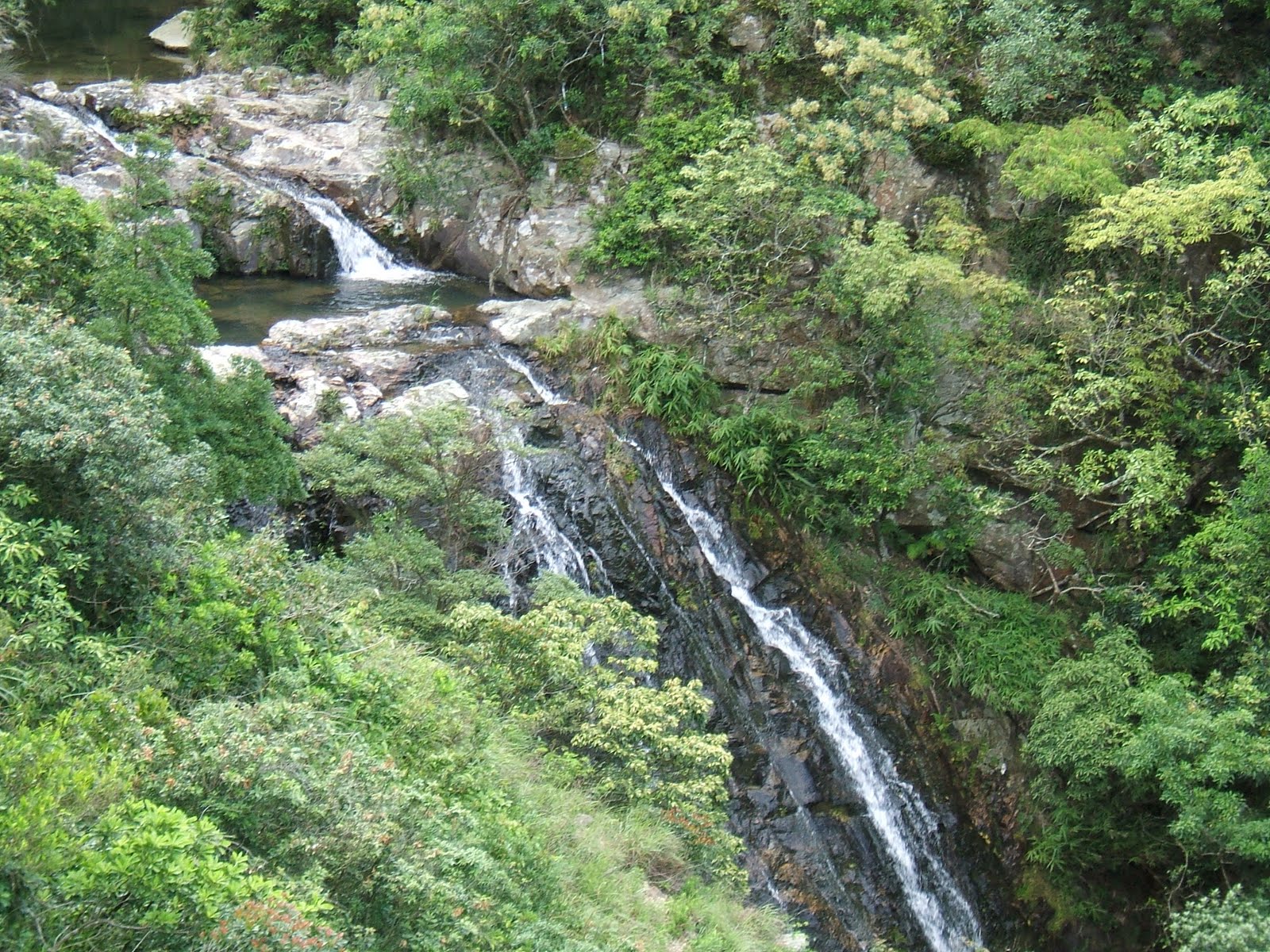
We tried to locate distance post L060, but none was in sight, for we needed to make a left halfway past this L060 post. We had no choice but to estimate the distance. Thank God, in the approximate vicinity, we managed to spot some ribbons (left by previous hikers) tied to the branches at the entrance of the path uphill. We gave it a shot. My gosh! This uphill climb wasn't easy for me, at some parts of the path, we had to bash through overgrown bushes and some even reached up to my head. All the spiders in Hongkong must have congregated on this path for their summer camp!! hahaha there were zillions of them! D had to do the men's thing and cleared the path for me! : ) Still, at one point a stray strand of spider web got into my mouth... yucks! I was thankful it wasn't the spiders though!! ;) By the time we emerged from this primary forest, I was pretty exhausted. This path led us to a pool/dam which they named Heaven's pool. We took some photos and continued our way up to Man Cheung Po main waterfall. The 70m high Man Cheung Po waterfall is beautiful. It is one of the nine most famous waterfall in the whole of Hongkong. After taking some photos, we took the forest path on the right of the waterfall up to Nose Mucous waterfall (I know..what a name, isn't it!). Oh my! The climb was really challenging, I had never climbed anything so steep and for such a long way up before... I almost had a cramp in my right calf. We took a short break at the Nose Mucous waterfall, had some snacks... and it was back to more climbing again! After reaching the Nose Mucous waterfall, I thought there will be minimal steep climbing for the rest of the journey, but on the contrary, we had to climb up the forest path on the right side of the waterfall and then continued climbing up to the peak of a pyramid hill (located right after Nose Mucous waterfall) just to get to the exit of this stream. Thank God the weather was good during this period of climb.
At the top of this pyramid hill, we hit the footpath that led us to Man Cheung Po campsite. After passing by the campsite, we visited Lung Tsai Ng Yuen. It's a hit or miss with this place, sometimes it is open, sometimes it's not. You get to go in if the caretaker is there cleaning up the place, if it's his day-off... too bad! ;) We managed to go in and had a quick look around and took some photos of the place. Frankly, the place is pretty rundown and the bridge is being barred for safety reasons. What a pity for such a beautiful place! After awhile, we left this sad place and went back to Tai O for some iced milk tea and yummy sandwiches. It perked us up alright. The whole journey took us about 4 hours excluding the bus ride both ways. Overall, it was a good and challenging trip, more so than expected. I really worked those 'muscles'! Also, just a note, we weren't tempted to take a dip in the pool at all ..... the water was not as clean as what we were accustomed to... (we were being pampered by the unpolluted water from the five dragon streams), so we didn't have the desire to go into the pool.
Warning: The last part of the journey down to Tai O ( after Lung Tsai Ng Yuen) entailed a really steep and never-ending descent, please wear your kneeguard, you might just need it! hahaha
 
scenery below heaven's pool
heaven's pool
Man Cheung Po waterfall
Nose Mucous waterfall
an unknown waterfall
an unknown pool behind the pyramidal hill
beautiful scenery from the top of pyramidal hill
Lung Tsai Ng Yuen